

In today’s world of GPS devices and mobile map apps, navigation is something that most people don’t have to think about on a daily basis. But when it comes to survival and emergency preparedness planning, the subject of navigation is definitely something that needs to be taken into consideration.
Should the grid go down, the cell networks become compromised, or GPS satellites targeted in a large-scale attack, many of today’s younger generations would struggle to find their way around their own towns, let alone try to bugout to a location outside the danger zone.
At minimum, you should always carry a compass, and of course learn the basics of navigation. But let’s take a look at some of the other navigation items that you may want to think about stocking up on, or including in your list of emergency preparations.
Why paper maps are still important
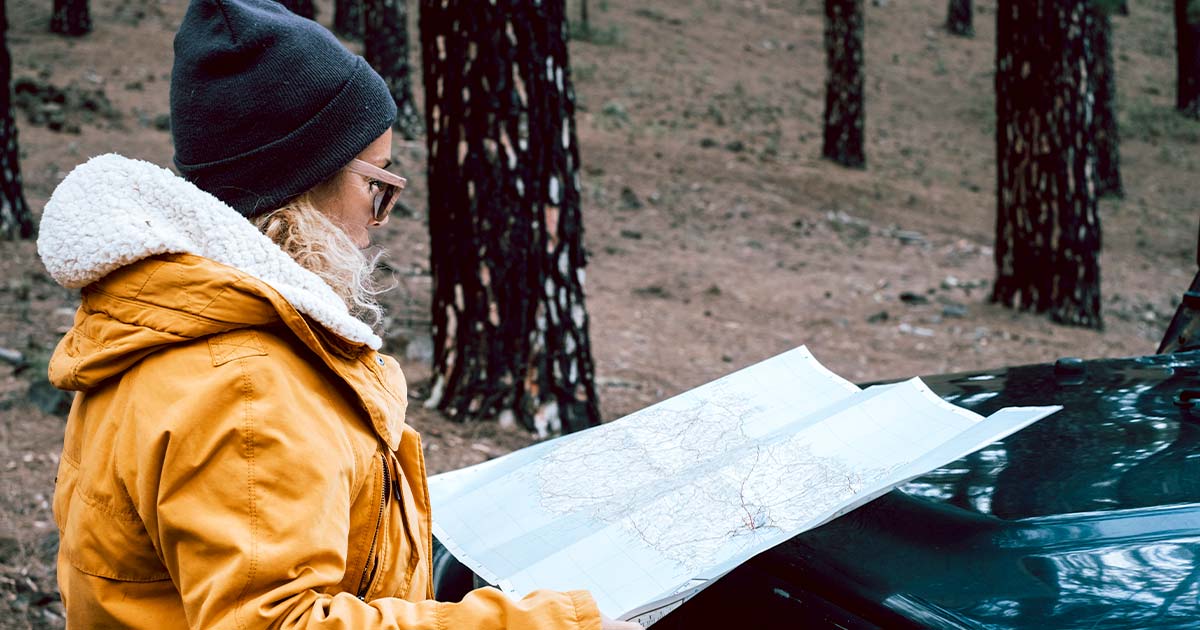
In today’s digital age, it’s easy to assume that paper maps have become obsolete, replaced by GPS systems and smartphones that offer real-time directions. However, despite the proliferation of digital mapping technologies, paper maps still play an essential role in our lives – especially when it comes to emergency preparedness!
Paper Maps Offer a Bigger Picture
One of the primary benefits of paper maps is that they offer a larger view of the world than digital maps. While digital maps allow you to zoom in and out and navigate your way around, they can be limiting in terms of the amount of information they can display on a single screen. On a paper map, however, you can see an entire region or even a country at once, which can be useful for getting an overview of an area and understanding how different places relate to each other.
Paper Maps Are Reliable
Another advantage of paper maps is that they are extremely reliable. Unlike digital maps, which can be subject to glitches, errors, and technological failures, paper maps don’t require batteries, an internet connection, or any other external power source. You can navigate any terrain if you have a map and a compass.
Paper Maps Don’t Depend on Technology
In addition to being reliable, paper maps also don’t depend on technology. This means that they are particularly useful in remote or wilderness areas where there may be no cell service or Wi-Fi. In these situations, a paper map can be a lifeline, allowing you to find your way back to civilization in case of an emergency.
Paper Maps Offer a Different Experience
There’s something special about using a paper map that you can’t replicate with a digital map. Holding a map in your hands, unfolding it, and tracing your finger over the contours of the land can be a meditative and satisfying experience. It can also be a way to disconnect from the constant stimulation of technology and engage more fully with the natural world.
Paper Maps Can Be Artifacts
Finally, paper maps can be artifacts that have historical, cultural, or sentimental value. Old maps can tell us about the way the world was perceived and understood in the past, while maps that have been passed down through families or collected over the years can hold memories and associations that are deeply personal.
MAPS: Preparedness Maps to Stockpile
If the grid goes down and your fancy electronic devices stop working, you may have to rely on good old-fashioned paper maps. Roadmaps, trail maps, and topographic maps can all be extremely valuable, especially in an off-grid SHTF situation.
Road Maps – I suggest having a number of different road maps. A national driving atlas, a local road map, and maps of your surrounding areas are all good items to keep inside your vehicle.
Google Maps – A great way to be prepared is to map out your evacuation routes on Google Maps, and then print them out. The great thing about Google Maps is it gives you the ability to plan out multiple different routes, including walking routes and back country trails that may not be listed on regular maps. Take advantage of their satellite view, and print as many different route options as you see fit.
Topographical Maps – TOPO maps are great for those times that you may have to bug out on foot, and are packed full of useful information. They can be found online or at most outdoor hiking stores.
Topographical Maps can help you find things like:
- Roads and trails, railroads, buildings, campgrounds and vegetation.
- Where you can find water (streams, waterways, and even water tanks).
- How difficult the terrain will be (elevation and steepness of slopes).
Recreation Maps – Another valuable source of navigation information can come from recreation maps. Most welcome centers and ranger stations have these maps. Whenever I hike a new trail, I try to pick one up for future use.
GPS Devices & Electronic Gadgets
Although I would never rely on any of these items as my primary source of navigational information, they can provide a wealth of information that may be useful during the early stages of a disaster.
Backpacking/Hiking GPS Devices: The most helpful feature of GPS devices designed for hiking is their ability to download way-points, routes, and topographical information right to the device. You can literally download your entire route including caching points, campsites, and watering holes. Combined with a good solar panel like the Goal Zero Nomad 7 Plus Solar Panel you can keep these devices going even during a grid-down situation.
- Garmin Tread Overland, All-Terrain Navigator: This is one of the higher end GPS Units on the market, but it really gives you a good idea of the wealth of information that can be stored on these units. The thing we like about it is the turn-by-turn trail navigation for unpaved roads and trails using adventure roads and trails map content.
- Magellan TN7881SGLUC TR7 Trail and Street GPS Navigator: Another good GPS device, one designedfor both offroad and in city modes, is the Magellan TN7881SGLUC TR7 Trail and Street GPS NavigatorThe unit comes Preloaded with Over 100000 4WD ATVs Motorcycle and Snowmobile Trails.
Road GPS Devices: The great thing about these devices is they give you the ability to quickly recalculate, and reroute your destinations during an emergency. One word of caution; during an evacuation scenario where everyone is trying to get out-of-town, these devices may cause you to become hopelessly stuck in heavy traffic.
Keep in mind that everyone else is probably using their GPS, which in all likelihood is giving everyone the exact same route information. During this type of situation, I would probably not take the first route suggestion, but instead use the device to find alternative back-road routes.
Smart Phones: Most smart phones can now do everything listed above through the use of downloadable apps. Depending on your phone, you may be able to store PDF maps and navigational information directly to the device, which will help even if the GPS satellites go down. Combined with a small solar charger, like the Goal Zero Nomad 7 Plus Solar Panel, this might be one of the best options to consider.


I have not used the term “chains” (1 chain = 66 feet, 20 chains = 1/4 mile) in ages. You are dating yourself.
When I teach the scouts, I do have them pace 100 feet out and back for them to obtain ‘their’ specific pace. Then we discuss the use of pacing beads to help keep track.
Treasure Hunts… try Geocaching for fun treasure hunts and developing you navigational skills.
Looking at your links, a very good detailed description of UTM, and determining N/S.
GPS is the navigation system of the future. Every airline, cruise ship, container ship and military outfit uses GPS for navigation and pinpoint accuracy of munitions delivery &tc. There is absolutely no reason for “batteries to die”. Ever heard of rechargeable batteries and inexpensive solar chargers? Get with the program folks and join the 21st century! GPS is the ONLY way to go. Learn how to use it!
Yes, the GPS is the navigation tool of the future, actually the present. Flying a private plane it is also used in conjunction when plotting a course following dead reckoning methods.
Sure GPS is the tool of the future as compared to a compass, just as the calculator was the tool of the future compared to the slide rule. I still now how to use a slide rule as well.
This is an “off grid” survivalist blog, and in the event of an EMP disabling all electronic devices including solar chargers, bring us back into the 19th century, unless they have been hardened and / or stored in a Faraday cage, retaining the skills from the past may be your only option to accurately navigate between points.
Don’t get me wrong, I have them, use them, and love the neat features they have incorporated; I am just leaving my alternative options open.
Couldn’t give me a GPS, in fact, I have that feature disabled on my cell phone. I drive truck cross country and can’t believe how many sheeple rely on GPS and either have forgotten how to read a map or they never new how to begin with.
I will stick with the good ole map and a local map..no traces to me. now a days trucking is moving to that gps locator crap. LIVE FREE OR DIE
I mean compass..
And tell me, what happens when there’s a GPS jammer out there (they exist btw), the satellites are attacked (another possibility depending on which contingency one is talking about), your GPS system breaks, the system used to recharge your batteries breaks, etc, etc, etc.
Simply put, having a backup is never a bad idea. And while a backup GPS is nice, should something happen to the GPS network you’re SOL and have no control over it. Things like maps are something YOU control and thus are better prepared for the worst.
Mike, I agree with you 100%. We must try to maintain basic skills(map and compass) while taking advantage of the wonderful technology available to us. A Faraday cage is a great idea and a truly prepared person would have one stuffed with electronic goodies he/she wanted to protect.
More of an FYI than anything, but US military and some civilian survey equipment is accurate down to 1 millimeter.
Good Points all around. I recently found a source for free usgs topo pdf’s, down to 7.5 minutes. I’m loading em on a 1st gen kindle. I figure a balance of what maps I carry/ how detailed the information is/ Ease of recharging and duration of battery/ overall weight including compass.
Things like gps take time to learn how to use, take the time and develop the skill-set and Experience the task… THEN learn and use a tool, if the tool still seems beneficial. More money is spent by people who dont know what they are doing in the first place. A little critical thinking and research, ask a friend or talk it over with a newbie- tell em what you wanna do and what you are thinkin… Give it time and thought, then get on Amazon and buy what you need. Or do like us and recall the experiences you have already had- “if I had to do that again…”
(I wouldn’t carry a pound of large scale road maps into the bush with me, thinking that “…they might help.”) x) – Travel Lite
if you draw a circle on a hilltop and take a stick that equals the diameter straight up when the shadow of that stick hits the edges of the circle at dawn and dusk you will have east and west and when you take a parallel line from that to center of circle you have the degree latitude that you are at. when you make 90 degrees from that line you have north and south. booya.
Navigation is a huge weakness of mine. If the tech toys stopped working, I’d be hosed.